Lake Samsonvale (North Pine Dam) has been stocked with a variety of native fish species since the early 1990’s. A downside for the fishery is the lack of natural structure in the lake as it was substantially cleared of vegetation prior to the flooding of the impoundment. Most remaining vegetation has since disappeared due to natural degradation, flood events and further clearing. This lack of structure limits the areas in which fish congregate and reduces the cover available for bait fish and fingerlings. The Habitat Enhancement Program (HEP) seeks to redress this situation by the construction, deployment and monitoring of Fish Aggregating Devices (FADs).
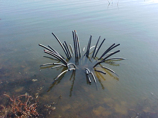
Fig 1 – Spider FAD
A variety of FAD structures were considered in consultation with Seqwater and DAF. These include:
Spiders – Structures comprised of UV stabilised plastic (PVC or poly pipe) mounted in a concrete base.(Figure 1 )
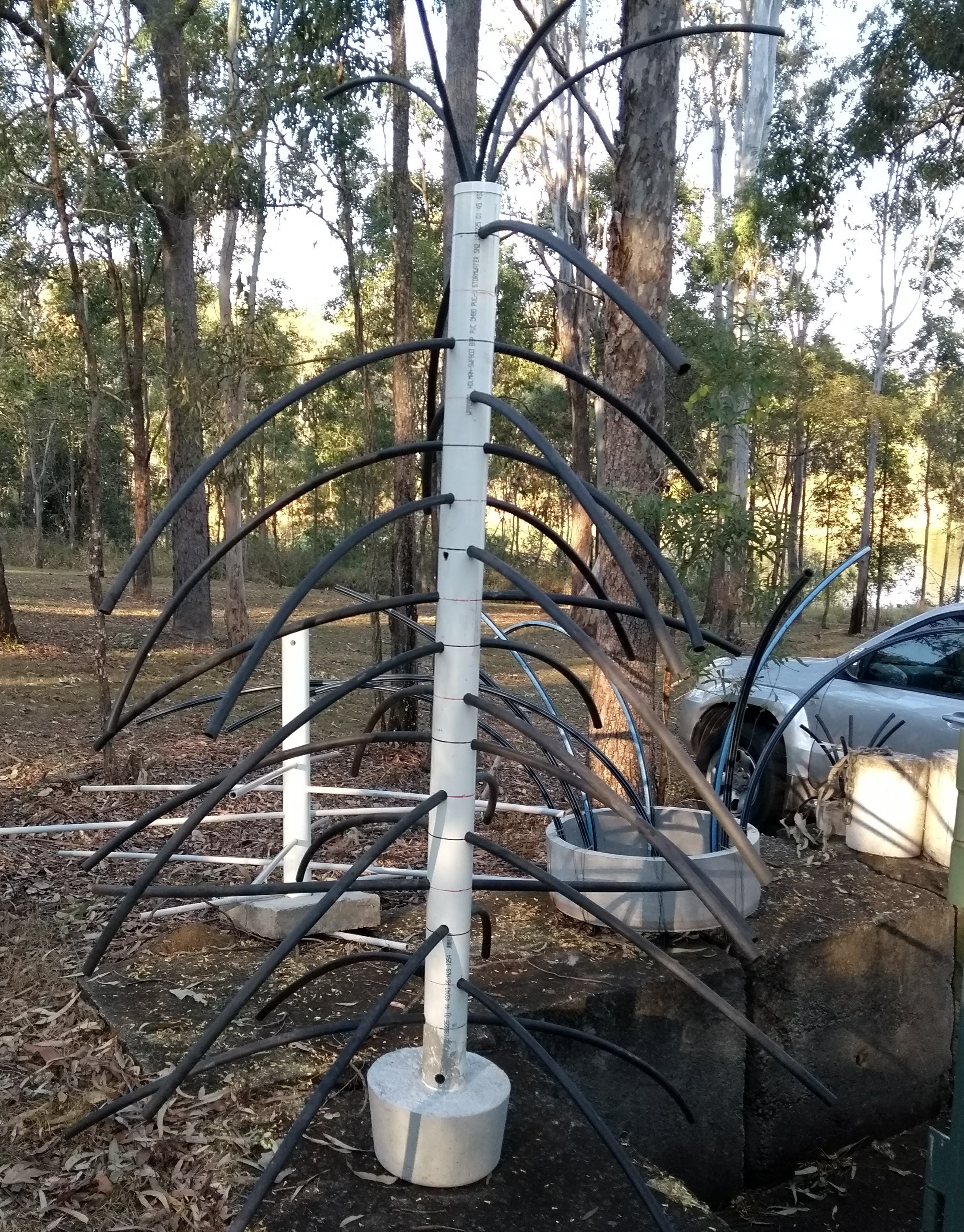
Fig 2 – Tree FAD
Tree structures – Tree type FADs typically comprise a central “trunk” made from PVC pipe with a number of “branches” made from smaller poly or PVC pipe. A “bushy” top made from smaller diameter poly pipe is added. Again the trees are set in concrete bases and have some stabiliser structure to minimise the possibility of tipping over ( Figure 2 )
These plastic pipe structures will not deteriorate under water, have little impact on water quality, are easy to construct and do not damage boat propellers.
Considerations for FAD locations.
In considering the location of the structures, several factors are considered:
• The bottom composition – preferably located on harder bottoms
• The FADs should ideally cover one third to one half of the water column
• They should not become a navigational hazard at lower water levels
• The depth of the thermocline in summer needs to be taken into account
• FADs should not be located in areas subject to increased water flow in flood situations
To achieve the optimum outcome, the following steps were taken:
- Structure maps were developed using sonar mapping with Lowrance structure scan technology to increase our knowledge of the composition of the lake in its present state. Sonar logs captured were used to generate maps of bottom composition and vegetation layers, and these, along with contour maps, form the basis of a knowledge base to determine optimum placement of FADs. (Figure 3 & 4)
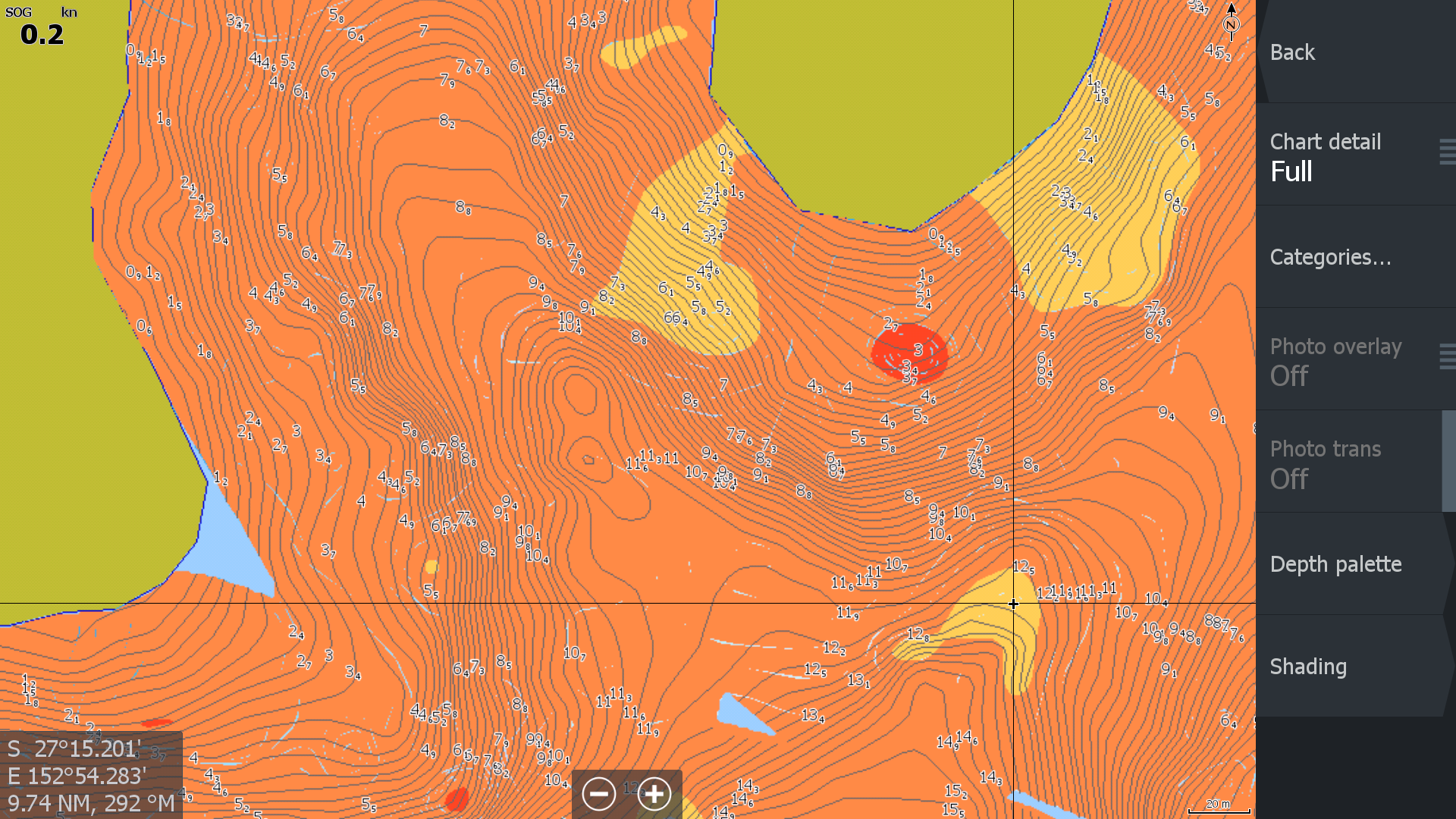
Fig 3 – Bottom hardness mapping
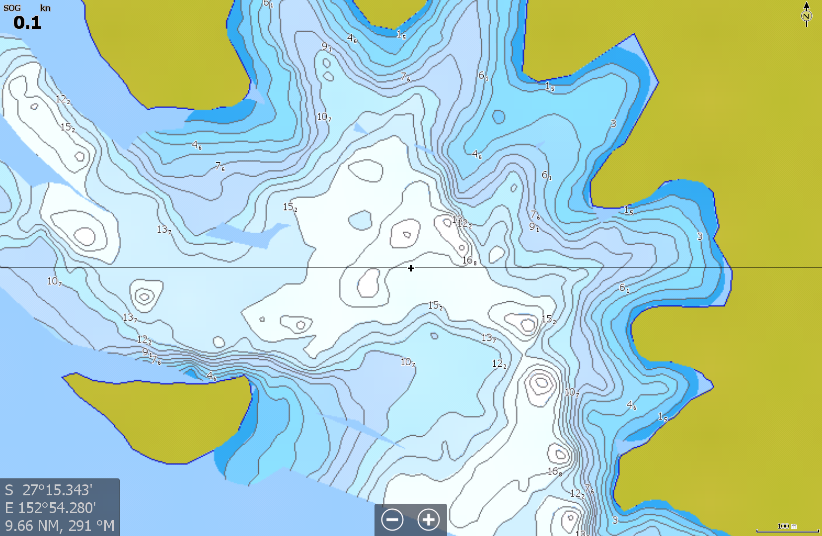
Fig 4 – Contour map
Deploying the FADs
PRFMA volunteers have spent many hours constructing and deploying the FADs. A video on FAD deployment can be found HERE
Locating the FADs
The location of each FAD cluster is identified by a highly visible marker buoy (Figure 5). A map and further information on the the FADs, such as configuration of the clusters and location of the FADs relative to the marker buoys, can be accessed below:
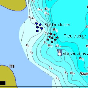
Fig 6 – Typical FAD cluster
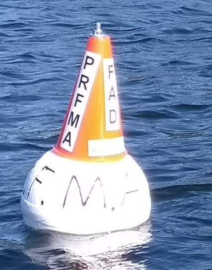
Fig 5 – Marker buoy
Generally the FAD clusters will comprise a number of “trees” deployed in deeper water, with a cluster of “spiders” in shallower water towards the shoreline. The map above will show the FAD configuration for each cluster (Figure 6)
The FADs will show up on sounders with images as shown below (Figure 7)
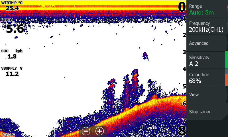
Fig 7.1 – Sonar image
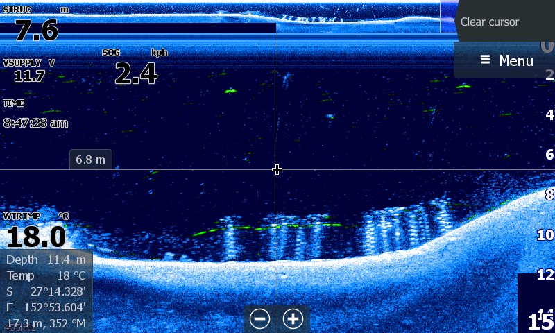
Fig 7.2 – Downscan image
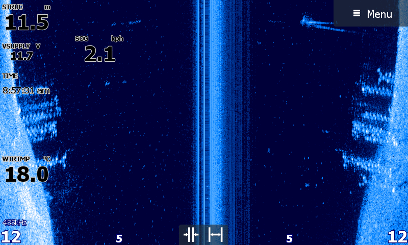
Fig 7.3 – Sidescan image
Measuring the success of the HEP
The success of the FADs will be monitored by:
• Video and photos of the weed growth on the FADs and the presence of fish in the vicinity. A video of such can be found below
• Recording data on catches on the FADs vs non-FAD locations. This will be carried out by PRFMA members but other anglers keen to participate in such studies should contact the PRFMA
Acknowledgements
The PRFMA wishes to acknowledge the following for their valuable support for this project:
Seqwater – for scientific support and permission to proceed with the project
Dept of Agriculture and Fisheries – for scientific support and access to information on similar projects currently underway
Moreton Bay Regional Council – Supply of material
Iplex Pipelines – Brendale – supply of material
Bunnings Brendale– supply of material
The Irrigation Shop at Slacks Creek – discounted supply of material